

Date walked: 17th May 2016
Distance: 14.25 miles
Map used: OS Explorer OL 13 Brecon Beacons National Park (Eastern Area)
Guide: Cambrian Way by A.J.Drake (7th edition) and website
***************
Sadly, Paul couldn’t make it today so it was just Neil and I who met at Crickhowell, leaving Neil’s car there and taking mine to the start of the walk at Gospel Pass. The car had done the hard work of bringing us up to an elevation of around 1800 feet; it was only half a mile but around a 500 feet climb up the well-laid gravel path to where we had left off last month on the summit of Lord Hereford’s Knob. Rain was forecast for later but right now we still had a great view back to Hay Bluff, the little road snaking its way down to Hay-on-Wye.

Do make this drive sometime!
There is no Trig Point at the top but a piece of concrete with some metal embedded in it suggested that there had been some kind of marker here.

Or is that an ex-Trig Point top?
We re-traced the route that we had taken last month to where our previous walk had arrived at the escarpment. Mostly the face of the hill’s steep slopes were grass-covered but one section seemed too inhospitable even for this undemanding vegetation, revealing the red sandstone strata.

Land slip?
Our first Trig Point of the day was the 2,339 feet Rhos Dirion, though this wasn’t the highest part in the vicinity. Pause for a pic.

My sitting on Trig Point days may be over
We stopped for a coffee about half a mile further on, still close to the lip of the escarpment with a wonderful view of the wide Wye valley. This was the first outing of a new (Genuine) Thermos flask. I had got fed up with getting a tepid drink a couple of hours into a walk. This did what it said on the tin; my coffee was still very hot.

What do you mean this is product placement?
Having indulged Neil with a spot of surreptitious pointing….

Not nearly subtle enough, Neil
…. we continued to climb gently, now heading due south. Ahead, the sky looked like it was preparing to dollop some rain on us.

Below us to our right, the lush green land of Grafog farm and its neighbours was in stark contrast to the steep bracken covered slopes that shelter the narrow Rhiangol valley.

This contrast was made all the more stark when the sun kept breaking though the clouds over the valley, making the fields glow.

According to the Guide a small cairn marks Pen y Manllwyn, but I guess it was too insignificant for me to bother with a pic or I was still more taken with our views. Less than a mile from here, we reached Waun Fach . This inconspicuous highest point of the Black Mountains – at 2,661 feet – is no longer marked by a Trig Point. But marked it was, by a newly laid path created with a Welsh Assembly grant as an attempt to keep walkers from lessening the impact of their ramblings on this well-worn landscape.

OK, I may have gone a bit over the top on the sky
The Cambrian Way takes a right turn here, heading West again briefly, the tops of the hills ahead hidden by clouds heading our way and which presently gave us a sharp shower.

To be a bit picky (moi!), this path was a bit of a scar in itself
The newly laid path turned south and then stopped.. …

Neil being strident
… giving way for a while to a rather more demanding surface of somewhat unevenly laid slabs of rock.

You would need to be blind and your Guide Dog deranged to take the wrong route on such a path, but today I was taking no chances, having downloaded the map onto my phone and then having plotted our route onto the map beforehand. My phone then kept track of our whereabouts through GPS. I gave myself much pleasure during the day by frequently showing Neil where we were AND that this was where we were supposed to be. He was impressed.

Eyebrow alert, Charles
A small cairn marked on the map a mile or so further on gave Neil his next chance of a photo opportunity.

Neil looking immensely rugged in this pic
A little further on, around Pen Traumau, part of the ground was looking very strange. A section of the peaty surface had what appeared to be the remains of a woollen like matting or sheet held down by pencil-shaped little stakes. I had come across an image recently of an artwork called the Coffin Route Blanket on the Black Mountain further west in the Beacons that was similarly constructed. With a bit of browsing (I LOVE Google) I found that this was, I think, part of a much larger project established in 2010 called The Woollen Line. It’s intention was to re-vegetate the landscape but it clearly hadn’t worked.

With rain drop smudges
Ahead of us, the path was clearly visible dropping down a little and then taking the ridge of the hill to Mynydd Llsiau.

Lord Macnamara’s Road on the left of the hill. see below.
I had been introduced to this area a couple of years ago by Kevin Walkers excellent book of walks, “Undiscovered Wales” . A lower path running along the side of this almost mountain, which then crossed our route, is known as Macnamara’s road. Story has it that in the late C18th a John Macnamara had this road built to accommodate a coach and pair and thus facilitate him in some illicit liaison with a woman in the adjoining valley. We found a rather good shelter at this point and, ignorant at the time of this most expensive recreation, enjoyed the view and a cup of coffee (yes, still hot).

I am indulging Neil with a bit of a smile, here
The climb up the side of Mynydd Lysiau looked a bit intimating but we were soon on its top, though now a thick mist was obstructing what would otherwise have been a splendid view.

I am beginning to feel a bit cold
Walker describes the next couple of miles as an ancient cefn-ffordd (Trans. “ridge-way”). The mist lifted a little as we marched through the now slightly springy ground, giving us a glimpse of the surrounding countryside.

As we approached our next summit of Pen Twyn Glas, Neil headed off to the left, wanting to see if the visibility was any better on that side of the hill.

It wasn’t, but as we walked the sky was extraordinarily dynamic, the mist lifting briefly and the sun making emerald-green the fields below.

These moments of sun in the valley were quite magical
Pen Twyn Glas (2,119 feet) has quite a flat top with several tributary paths leading to it. I took one to the right, Neil to the left, him coming across a pair of stones ….

He does love to point
…..which at the time were a mystery…

Thanks to Neil, again for this pic
… but which Walker says are another example of boundary stones (in fact I see now that the map does have these features as “BSs”), here marking the edges here of Macnamara’s Llangoed Estate. There is another good story about them but you will have to get his book if you want to hear it.
From Pen Twyn Glas to the Trig Point of Pen Allt Mawr was about a mile, the land rising a couple of hundred feet. We passed a good sheltering point….

Someone put a lot of effort into this; needs a roof really
… and a small herd of small group of sheep…

At last, some sheep!
…. the weather continuing to frustrate and then allow our sightseeing.

The Trig point at Pen Allt Mawr (2359 feet), has seen better days.

In need of adoption?
Still heading south, the pile of stones that marks Pen Gloch y Pibwr must have taken some assembling, raising the question “why?” No answer did we find.

All theories welcome
From this point the path turned south-eastwards, once again the valley below (now the Usk Valley) prompting very repetitive “oos” and “ahhs” from us as the sun came….

…. and went.

Our last Trig Point of the day (this must be some kind of record number passed in one of my day walks) was Pen Cerri-calch (2,300 feet) , where a fairly damp-looking Neil was beginning to look a little tired.

Tired but happy
The next half a mile or so was not my favourite bit, the surface of our path now comprising pretty rough and uneven stones and necessitating some careful footwork.

Be fair, I am not complaining much on this walk so far.
But is was downhill all the way from here and soon we were below the mist and clouds with a view down onto the iron-age fort known to the English as Table Mountain and to the Welsh as Crug Hywel.

Loved that curved stone wall to the right
The descent to this last little summit was quite steep, and accompanied by various “ows” and “ouches” from Neil, whose aged thighs were beginning to give him gyp (gip?). It gave us our last moody sky of the day.

Yes, a little enhanced by Lightroom’s grad filter.
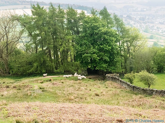
With a chorus now of “ows” we zig -zagged through the bracken to civilisation, in the form of a stone wall and a bunch of frisky sheep who seemed to want to pretend that they were cornered and then ran off dementedly when they discovered that they were not.
I had done a walk up from Crickhowell to Table Mountain before so this next bit was quite familiar, but I don’t remember it as being so lovely.
The edges of the fields had a fringe of bluebell and stichwort, proving once again that nature is a pretty good gardener.

And the fields themselves had happy lambs gambolling amongst a carpet of meadow buttercup.

Little Lambies! (well quite big, really)
Even the cattle were lovely.

Not as lovely as an Aubrac, but still very kissable
The more grown up sheep in our last field were oozing contentment.

I thought this one looked positively smug
We had a few stiles to climb over, which was a challenge after nearly 14 miles. At the last one we were faced by a black pig, who, though as apparently happy as all the other livestock we had just encountered, did not seem entirely happy with our presence.

I think its time for a pig to get on Britain’s Got Talent (just saying)
I suggested that Neil make a run for it and if all was well I would either a) follow and if not, I would b) call an ambulance. I think it was just grunting a greeting rather than a warning, but my Pig is a bit rusty.
Back on a road, now, we had just half a mile to get to the car. It felt a bit of a culture shock to be walking past houses after such a wonderfully immersing day in the hills. The more so for some ghastly bit of sculpture in one of the gardens we passed…

Yuk
….and to now have our views of the hills framed by grey roofs and solar panels.

Well, we’ll be back in the hills soon. And for the next walk we are planning to camp. What larks!


Dull and/or misty days often seem to give you more photo opportunities than bright sun. Nice. Though does Anne know that your penchant for snogging Aubracs has now extended to all bovine species? Should we worry at the prospect of you camping overnight in a field full of cows? And it’s a shame you’ve given up jumping onto trig points. There are some of us who were anticipating hearing recordings of your grunts * (when you’d finished listening to birdsong).
*Note nifty bit of blog crossover.
Definitely. Bright clear days are very boring, picture-wise. I make no apologies for my remarks about the cow; we are thinking of a weekend away together. I think Trig Points have got taller.
You need a proofreader.
What is to become of getting lost and Neil pointing if you are to be directed by GPS all the time??? That’s no fun.
I’ve re-read it and I still can’t see the “incoherence” (remark made off line). I know, I am worried that all the fun may be lost by route plotting. I’ll tell you when I get back from Scotland.
Well, a great photo and account of a great day out in the hills. It still surprises me that somewhere as relatively tame as The Brecons can have a 14 mile ridge walk, crossing no roads whatsoever. It did feel far away from madding crowds, and such. A lovely day, and not too damp.
Thanks. We’ll try and make the next walk really wild!
I am peeved that I missed that walk – however the kissable cow and the uppity pig malarkey cheered me up. Have you been manicuring your eyebrows Charles ?
You’d have been sent first to brave the pig. I’ll not discuss my beauty regime here- ask me on the next walk.
Not a part of the world I know at all, Charles and quite wonderful. Makes me wonder why I bother driving all the way to the Lakes ALL the time. Given me something to ponder definitely – and a mind to sit on every trig point I come across, or at least try. And you’ve reminded me of the joys of a Thermos on walks – we once climbed mountains in Cumbria with flask and china tea cups, which everyone needs to do, we decided. D
Hi David,
As an immense lover of the Lakes (given my surname, I’m obliged to), I would agree that The Brecons are worth some time. They’re nothing like as rugged, and none of the astonishing light contrasts between lake and mountain, but they are higher than you might at first think, a more gradual ascent, so, as in this last walk, one can be ‘in the clouds’. I think what strikes me most, however, is how remote one can feel in them. In many of the walks thus far we have had the Beacons to ourselves, not coming across another soul from ascent to descent. A fabulous day out.
🙂 Neil
It is. And a lot closer to you than the Lakes, though I think Neil is right. They are very different places. (Though I’d there no sensible train route to get you to the lakes?). Anyway, you must come and find out. Don’t think I’d risk china cups on a hike. Just equipped myself with some colourful plastic gear for Scotland next week.